East Coast Faces Impending ‘Bomb Cyclone’ Fury with Ferocious Storm Threatening Chaos

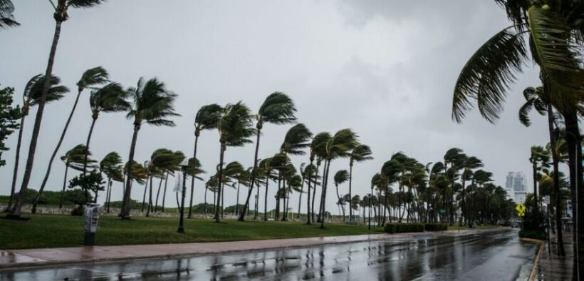
A formidable storm, unleashing gale-force winds, relentless rain, and potential flooding, is currently surging along a vast stretch of the East Coast. The ominous conditions raise the specter of a possible “bomb cyclone,” poised to wreak havoc just ahead of the holiday season.
The National Weather Service issued a wind advisory, covering over 32 million Americans, as meteorologists anticipate winds ranging from 40 to 70 mph along the coast, with potential gusts reaching a staggering 85 mph. Wind gusts exceeding 74 mph are categorized as hurricane-force winds, and the term “bomb cyclone” implies a winter hurricane.
Meteorologist Bernie Rayno from AccuWeather warns of the likelihood of significant damage along the mid-Atlantic and New England coasts as the storm undergoes rapid intensification. A corridor of robust winds is expected to push water from the Atlantic toward the shoreline, coinciding with heavy rainfall.
The affected region, spanning from North Carolina to Maine, is bracing for substantial rainfall, with predictions of up to 4 inches, and localized areas facing the possibility of a staggering 10 inches, as outlined by AccuWeather. This intense precipitation could result in waterlogged roads, causing disruptions in traffic for the Sunday night and Monday morning rush hours.
Originating from Florida and Georgia, the storm has already left 35,000 homes and businesses in these states without power. The potential for “dangerous marine conditions” may persist into the coming week as winds and seas are expected to subside gradually, according to the National Weather Service.
Florida and the Carolinas have already borne the brunt of the storm’s fury. Parts of Florida experienced up to 5 inches of rain, leading to flooded streets and the cancellation of holiday celebrations. Flood warnings and advisories were issued across the region.
Local authorities in Southwest Florida issued warnings about coastal flooding, urging residents to avoid swimming or boating due to hazardous conditions. In Fort Myers, where residents are still recovering from Hurricane Ian over 14 months ago, reports indicate severe flooding, with houses surrounded by water, docks submerged, and streets inundated.
Charleston, South Carolina, faced similar challenges, with around 4 inches of rain and tidal gauges recording over 9 feet by midday Sunday. Widespread flooding forced the closure of numerous roads in the city.
Georgetown, located northeast of Charleston, witnessed dramatic rescues of motorists stranded in floodwaters. Despite the flooding occurring in unexpected areas, no immediate reports of injuries or fatalities were received.
Over 28,000 residents across the Carolinas found themselves without power as the storm continued its path, as reported by PowerOutage.us.
As the East Coast battles the storm’s onslaught, hopes for a White Christmas are dwindling for many. Historical data suggests that chances of a white Christmas in more than half of U.S. states are less than 50-50. This year, AccuWeather forecasts only a few areas with a high likelihood of snow cover, including most of the Rockies and select pockets of the interior Northeast. While some snow may grace parts of the High Plains, north-central U.S., and areas adjacent to Lake Erie and Lake Ontario, the Northeast is unlikely to see snow in time for the holidays.


